Maps
Copperton Projects Maps
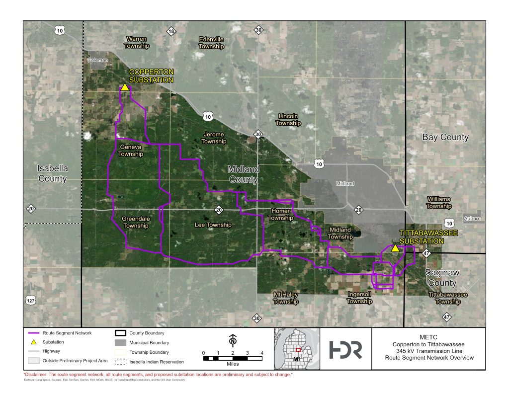
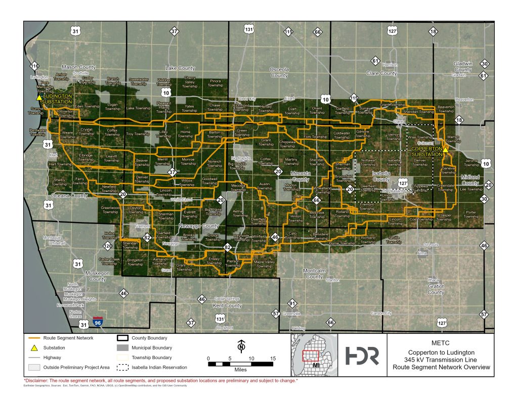
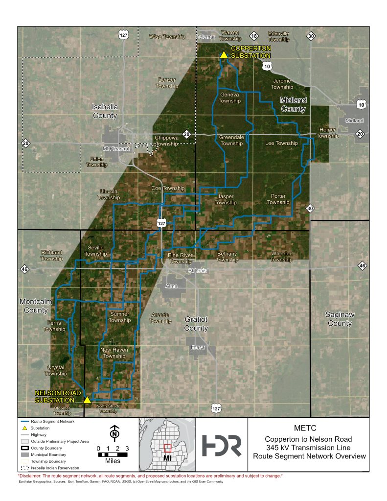
Three transmission lines will ultimately be constructed, with one line connecting the Copperton substation to each of the following substations: Nelson Road, Ludington, Tittabawassee. The current map depicts a network of potential route segments being evaluated as part of the early planning process. During this early portion of the project, please note that the route networks, all route segments, and proposed substation location are preliminary and subject to change. These routes or segments have not yet been submitted to or approved by the Michigan Public Service Commission.
Feedback received during the Community Listening Sessions, along with ongoing engineering, environmental, and field evaluations, will help inform the refinement of route segments and the development of potential route options.
The route segment network will be refined down to one proposed route and at least one alternate route throughout a multi-step community outreach and routing process. These routes will be presented to the Michigan Public Service Commission as part of the Act 30 process, and the Commission will select one route, if approved, for each of the three lines proposed for construction. In addition to the routes, ITC will add 345 kV equipment to Copperton substation (Salt River) in Midland County.
COPPERTON-LUDINGTON ROUTE SEGMENT NETWORK OVERVIEW
Build an approximately 159-mile, double-circuit 345 kV transmission line from Ludington substation in Mason County to Copperton substation in Midland County.
COPPERTON-NELSON ROAD ROUTE SEGMENT NETWORK OVERVIEW
Build an approximately 55-mile, double-circuit 345 kV transmission line from Nelson Road substation in Gratiot County to Copperton substation in Midland County.
COPPERTON-TITTABAWASSEE ROUTE SEGMENT NETWORK OVERVIEW
Build an approximately 40-mile, double-circuit 345 kV transmission line from Tittabawassee substation in Midland County to Copperton substation in Midland County.